
Robert W. Endlich
On 20 March 2021, I presented “Human-Caused Climate Change? Possible Lessons from Weather Modification Operations During the Vietnam War;” graphics are posted on the web site at this link.
The presentation delved into these subject areas: a personal timeline, geography of Southeast Asia, A History, from of the loss of French Indochina to the disclosure and declassification of US weather modification efforts, climatology and the monsoons, cloud physics and cloud seeding, cloud seeding history—mostly from newspapers, sensational stories and wild speculation, and serious research especially that led by the late Dr. Joanne Simpson.
[Whenever the author mentions SECRET and/or TOP SECRET missions, activities, or code words, he is referring to the classification at that time. Everything in this post has since been declassified. Ed]
I spoke on weather modification efforts by the military in Southeast Asia: Operation Popeye, 1966, Operation Compatriot/Intermediary, 1967-72, my 1969 in-flight observations over the Ho Chi Minh Trail, disclosure of the project, US Senate hearings, and declassification of this formerly TOP SECRET effort.

In doing my research, several unresolved items resulted in puzzlement for me including the now declassified early 1967 State Department memo which recommended pursuing cloud seeding, internet-available literature which is all over the place on details, and a popular, but seriously in error, post in Gizmodo.
My presentation graphics contain the above subject areas; those interested in my references and my thoughts can see both in the graphics; both are evident.Much of this post will be on my recollections, especially my in-flight experiences while flying cloud seeding missions over the Ho Chi Minh Trail. I criticize the errors in the Gizmodo article with facts and reasoning, elements in short supply by Gizmodo author Matt Novak.
My personal timeline
I joined the Air Force on 1 Feb 1963, graduated from Officer Training School with a commission as a Second Lieutenant on 7 May 1963, and spent the next year as a student of meteorology at Texas A&M University. I did very well academically and was elected by the faculty to Chi Epsilon Pi, the National Meteorology Honor Society.
My follow-on duty assignment was to Glasgow AFB, Montana, a Strategic Air Command base with an F-101 fighter-interceptor squadron, but the main unit was a SAC bomb wing with fifteen B-52D Stratofortress bombers and a similar number of KC-135A Stratotanker refuelers.
I learned a lot in a short period of time about the Air Force, I liked what I was doing, putting my knowledge of the weather to use in the operational art, forecasting for military training missions, operational readiness inspections and other non-routine missions.
This was when the country was getting deeply involved in Vietnam, and the higher-ups decided that all B-52Ds, including those from my own 91st Bomb Wing, would receive the “Big Belly” modifications, changes which would, in addition to nuclear weapons, allow our bombers to carry 108 conventional 500-pound bombs, and fly missions from Guam (and later Thailand) directly supporting our war efforts in Vietnam. The name for this mission was ARC LIGHT.
I was on the first aircraft when our wing deployed to Guam; I arrived on 8 Sept 1966, and soon started briefing the ARC LIGHT missions taking off from Guam, refueling near the Philippines, and striking targets in Vietnam or Cambodia, daily, SECRET missions.
Our partner wing was the 306th Bomb wing from McCoy AFB, Orlando, Florida, but soon thereafter there was a buildup of augmentee bombers and crews from other SAC units.
One day I briefed a fire-bomb mission into Vietnam where we had 36 aircrews, 30 for the mission, and 6 “spares,” plus the Third Air Division Commander, the 3AD staff, as well as primary staffs from both the 91st and 306th Bomb Wings, hundreds in the audience, heady stuff for a First Lieutenant.
There was one TOP SECRET B-52 mission in which we overflew part of North Vietnam enroute to bomb the Mu Gia Pass, on the border between North Vietnam and Laos, and on one of the main supply routes for infiltrating supplies for the North Vietnamese Army in South Vietnam.
One day on Guam I ran into another First Lieutenant, Ken Kaiser, who had been in my 1963 Officer Training School Class at Medina Base, adjacent to Lackland AFB, Texas. Ken and I came to know each other because we both were in the pipeline to become Weather Officers, Ken going to the University of Utah, while I was going to Texas A&M. While I was on Guam with my SAC bombers, Ken was an Aerial Recon Weather Officer with the 54th Weather Reconnaissance Squadron, a unit flying WC-130s, the Typhoon Chasers.
Ken pulled me aside and said that he was involved with a mission where the 54th WRS was going to be directly involved in the Vietnam War, but it was TOP SECRET, and he couldn’t tell me more.
After I returned to Glasgow <I previously had applied to go back to Grad School> the Air Force assigned me to Penn State, and I reported there in September 1967.
One day, during Cloud Physics class, the instructor, Dr. Larry G. Davis, told us of a recent seeded cloud and control cloud experiment near Flagstaff, AZ, (most probably an early part of Project CLOUDWATER, summer of 1965) where seeding of supercooled droplets with silver iodide was demonstrated unequivocally to produce enhanced cloud growth and enhanced rainfall from the base of the seeded clouds.
One CASF member, Charles “Charlie” Wagner was an Army Weather Observer at the time, on temporary assignment to Flagstaff, but he was not briefed into the real purpose of the extensive meteorological measurements at Flagstaff. Charlie learned about the real purpose of this measurement campaign only in recent years and gave a short talk during the presentation about his time at Flagstaff.
My next assignment was Chief Forecaster at Korat RTAFB, Thailand. I was weather briefer for numerous F-4E and F-105 strike and armed reconnaissance missions in Laos, and F-105 Wild Weasel missions against Surface-to-Air missiles and sites in Route Pack 1 in North Vietnam, by aircraft and aircrews from the 388th Tactical Fighter Wing.
We were part of First Weather Group in Vietnam, and the Group Vice Commander, during a visit to Korat, asked about my grad school research <Diurnal Variation of Moisture aloft over Southeast Asia> and promptly asked if I would consider transferring to be a “Special Projects Officer” at Tan Son Nhut AB, in Saigon. I agreed, and when I arrived in Vietnam the “Special Project” was the cloud seeding mission to enhance rainfall over the Ho Chi Minh Trail of Laos.
Nominally neutral Laos had been invaded and used by North Vietnam’s Army since 1959, actions clearly in violation of the agreement the North had signed at the 1954 Vienna Conference.
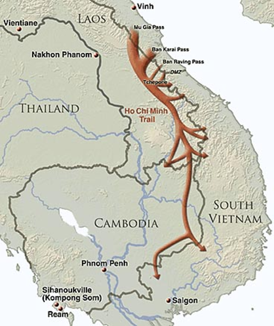
Figure 1 below shows the so-called Ho Chi Minh Trail, really a network of trails and route segments which were used by Communist North Vietnam to infiltrate war material to North Vietnamese Army troops in South Vietnam. With US air superiority over South Vietnam, this war material would have been destroyed by US aircraft flying over South Vietnam. Taking a more circuitous route over Laos, this logistic supply route offered cover and concealment.
http://overedicated.blogspot.com/2012/12/ashcan-01.html
Weather Modification’s Evolution
Here is a history of weather modification through cloud seeding beginning in 1946 with Vincent J Shafer’s discovery that dry ice could cause spontaneous change of supercooled droplets to ice and snow crystals, a very repeatable phenomenon.
The next 12-20 years is what I call the period of wild speculation and sensationalism phase, much of this from headlines and newspaper articles claiming, for instance, potential to change the Sonoran and Chihuahuan Deserts of Arizona and New Mexico into “rich crop-producing areas,” “torrents of rain over Russia,” and the ability to cause destructive droughts and drying up of crops by overseeding clouds, to give only a few examples from popular literature of the period.
From about 1958-1980 there was a period of serious research undertaken by the late Dr. Joanne Simpson and her colleagues at the National Hurricane and Experimental Meteorology Laboratory in Coral Gables Florida, aided greatly by Dr Robert White, Director of the National Weather Service.
This work included the DOD and the US Navy, Department of Commerce, and industry. An example is, “An Airborne Pyrotechnic Cloud Seeding System and its Use,” by Simpson and colleagues published in the Journal of Applied Meteorology in February 1970, which showed development and testing of flares which could be ejected from various aircraft on command. Simpson showed statistically significant (at the 0.5% level) increases in the heights of seeded clouds, and similar statistically significant increases in the amount of rainfall from seeded clouds. In one experiment of fourteen seeded clouds, thirteen “grew explosively.”
Project Names. I was in-briefed on the project when I arrived at Tan Son Nhut AB, Vietnam, outside Saigon, in June 1969. I was told the risk-reduction experiment, conducted in the Philippines in 1966, was called Operation POPEYE, and subsequent listings for the operational cloud seeding project during the Vietnam War incorrectly, in my view, use POPEYE. Declassified Department of State papers on this say that POPEYE was conducted late in the 1966 wet season in Laos, east of the Bolovens Plateau, not far from Cambodia. While I was in First Weather Group, the project name was COMPATRIOT/INTERMEDIARY. I heard that when these code words were compromised, the codeword became FOOTMARK, but this was after I left the project.
The call sign of the 54th Weather Reconnaissance Squadron WC-130A cloud seeding aircraft flying from Udorn RTAFB, Thailand, was MOTORPOOL, and this name is common among veterans of the Weather Reconnaissance community.
Rainfall Analyses
When I was on the project, the purpose was to enhance rainfall over the denied areas along the Ho Chi Minh Trail of Laos, to slow the reinforcement by North Vietnamese Army personnel and material to their forces in South Vietnam. Because of political constraints, we could not strike war material as targets in North Vietnam, we had to interdict the flow of supplies to North Vietnamese forces in South Vietnam by interfering with their logistics flow through Laos and Cambodia along the Ho Chi Minh Trail.
From AIR FORCE Magazine:
“Both infiltration and air strikes declined sharply during the wet season, the southwest monsoon, from May to September. The rains washed out roads and trails.” The project’s objective was to enhance rainfall to hinder the transport of material by truck and bicycle traffic and slow the pace of reinforcement to NVA units in the south.”
When I started, I was the night shift analyst and prepared nightly teletype reports to the Joint Chiefs of Staff and the intermediate headquarters.
I also prepared rainfall maps derived from the teletype weather radar reports from all the weather radar reporting units in Thailand and Vietnam, plotted hourly in the next building in our compound, the Southeast Asia Weather Center, SEAWEACEN. Soon after midnight, one of our observers would bring us the 24 charts, each containing an hour’s hand plotted teletype coded weather radar reports, RAREPS, from the previous day.
To codify and improve the previous practice, I devised a methodology to objectively convert the AREA and CELL reports to rainfall amounts over a grid I established over Southeast Asia. I used the coded intensity and coverage of the returns, the Radar Rain Equation and a tropical “Z-R” equation for rainfall rate from the backscattered weather radar return, assuming that the intensity did not change over that hour, and that the “beam-filling” requirement from the Radar Rain Equation had been satisfied.
From this analysis, I prepared unclassified daily rainfall maps over the areas of North Vietnam, Laos, South Vietnam, and Cambodia covered by our weather radars, contour maps, with intervals in inches, from memory, 0.01, 0.03, 0.1, 0.5, 1.0, 2.0, 3.0. and rarely 5.0 inches. In areas where the seeding aircraft reported good results, I would put red check marks. I hand carried these through the 7AF headquarters offices of the Commander, Vice-Commander, Director of Operations, Director of Intelligence, Chief of Staff, and laid the maps on the desks, typically ~0500L.
Flying Cloud Seeding Missions.
Being an aviation enthusiast but failing the eye exam part of the Air Force pilot physical, I flew with the crews I supported as much as I could and was delighted that First Weather Group sent some of us project analysts to OL-2 First Weather Group, Udorn RTAFB, Thailand to participate in the cloud seeding missions as an “additional crew member,” as it was called those days when we were part of Military Airlift Command. In August 1969 I spent several days at OL-2 at Udorn, flying the weather modification missions.
The WC-130A aircraft and crews were from the 54th Weather Reconnaissance Squadron from Andersen AFB, Guam, which rotated in and out on a temporary duty basis. Finding this out answered the question I had after talking to Ken Kaiser, 2-1/2 or so years prior, when we were together, on Guam. During my flights, I found the crews professional, and they obviously liked the mission, because they could clearly see the results of their work during the sortie.
There was nothing extraordinary about meeting up with the crew, the pre-flight briefing, preflight of the aircraft, take-off and climbing to mission altitude, about FL 200 or about 20,000 ft. MSL. Most of the time we flew over the Ho Chi Minh Trail area of Laos.
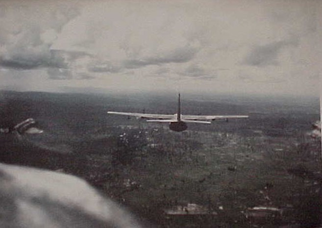
The operation consisted of flying directly into towering cumulus well above the freezing level and igniting/dropping a silver iodide flare into the supercooled cloud, typically one flare per pass, then flying out of that cumulus and observing the result.
It took several minutes for the silver iodide to convert the supercooled water droplets to ice, becoming snow crystals, liberating the latent of heat of fusion, and for that heat to result in added buoyancy and visible vertical growth of the towering cumulus clouds. The flare dispenser was affixed to the WC-130A fuselage hard point of the fuselage that houses JATO (Jet Assisted Take Off) bottles during JATO operations.
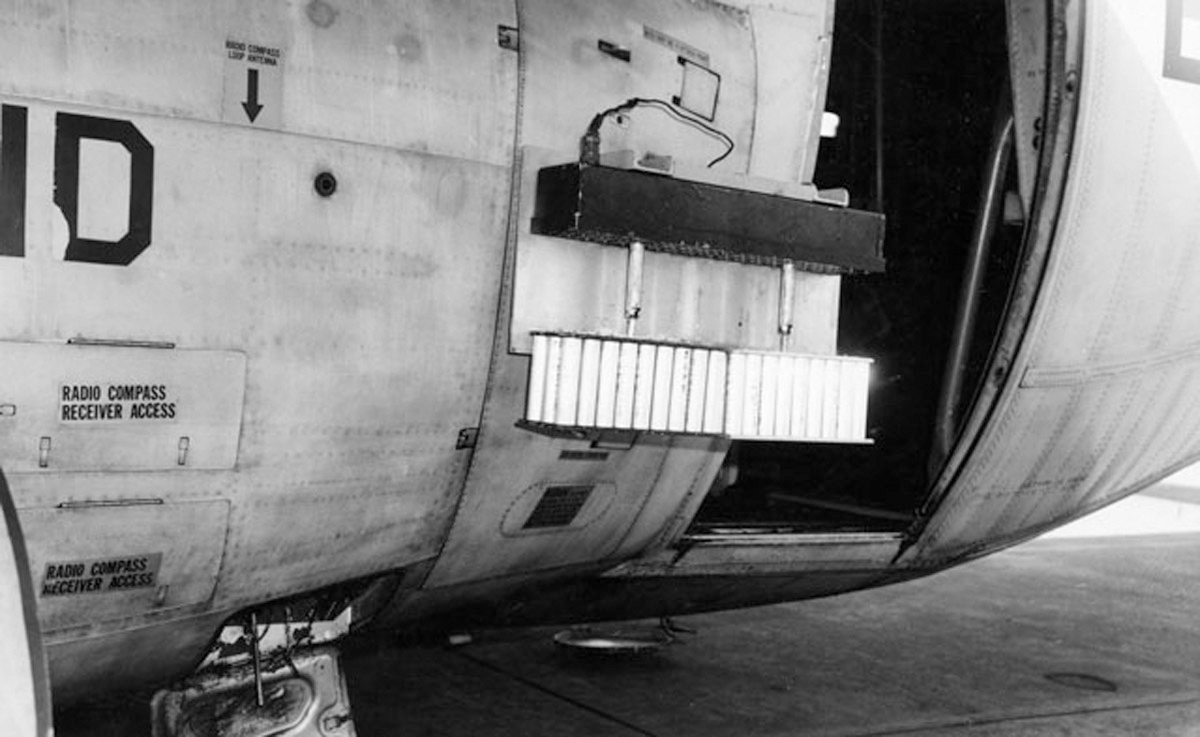
The above picture and caption came from the Gizmodo article.
On good days we could see positive results within five minutes, since the added buoyancy of successful seeding would show the cloud top actively growing with time.
Here are several notable results I observed while flying the missions:
On one occasion we dropped a flare into a narrow cloud tower, and we could see immediate vigorous acceleration of the cloud top, but this entrained dry air in from the sides, causing evaporation of the cloud structure. There was no doubt about it; we “killed” that narrow cumulus. This behavior matches the “K-parameter”, the 1/cloud radius term in cloud modeling, meaning that for the technique to be successful, we needed a good-sized cloud to start. We did not make this mistake again.
On numerous occasions, when the area was working nicely, we could “hit” one cumulus, and hit another one, then come back to the first one to see whether hitting it again would result in more cloud growth. We could hit three clouds over a 15-minute period to achieve excellent cloud growth over an extended area and could see the results in copious rainfall emerging from the cloud base, which further aided our decisions on the seeding sequence.
It was not unusual for us to encourage two seeded growing clouds to join, a “merger” which became a larger two-cell, even a multi-cellular complex.
On one such “good” day, we were busy working a good number of clouds over the Ho Chi Minh Trail of Laos; we were east of Nakon Phanom RTAFB, Thailand, and west of the Mu Gia Pass. The clouds were working so well that we had four pairs of clouds we were working in a group, then found another two pairs, each of which became a two-cell merged complex, and repeated. After working the second two pairs, we turned, and, looking back where we had started, the sky was black with a Mesoscale Convective Complex, MCC, of heavy rain.
There is no doubt in my mind that we created that MCC where none would have existed, because an inversion about 22,000 ft. MSL was inhibiting convection, but by adding the latent heat by flying directly into the towering cumulus and seeding them directly, we had converted the supercooled droplets to ice, liberated the latent heat of fusion within those supercooled clouds, caused cloud buoyancy in the complex to punch through that inversion, and merge with the other towering cumulus clouds we were working.
After I returned to Tan Son Nhut, in my APO mail, there was an article in the Journal of Applied Meteorology written by Dr. Joanne Simpson, saying that she and her NOAA group found similar results, creating MCCs from their cloud seeding operations in Florida. It made perfect sense, seeding supercooled droplets in towering cumulus clouds over a peninsula on the southeast side of a large continent in the warm season, the analog is almost perfect.
Below is a paragraph extract, a screen capture from a 31 May 1972 Comptroller General letter report to Senator Schweiker, from the GAO, which specifically addresses this phenomenon: 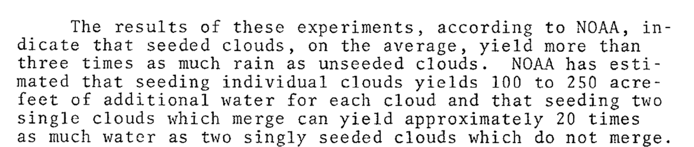
I am sure, almost positive, that this part of the letter report was derived from the cloud seeding experiences of Joanne Simpson and her group, part of NOAA’s National Cumulus Modification Project.
Simpson’s colleague, William L Woodley, in NOAA’s Technical Memorandum ERLTM-AOML 10, “Some Results of Single Cloud Pyrotechnic Seeding in Florida, 1970,” says, page 70,
, “…on fair days, the rainfall increases due to seeding are in the range of 350-400 acre-ft., or on the order of 400 percent of the unseeded clouds’ precipitation. The differences are significant at the 0.5 percent level.”
And, on page 81,
“We believe that with the 1970 experiment the growth and rainfall aspects of individual Florida cumulus clouds have been fairly conclusively established. Conditions have been specified quantitatively under which it is possible to greatly enhance vertical growth, consequently producing precipitation of more than 100 per cent or several hundred acre-feet.“
These are screen captures from Woodley’s report: 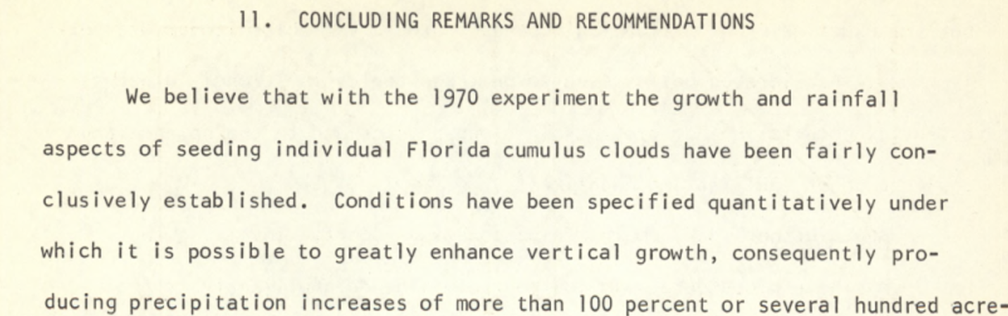 ft.
ft.
And,
 cant.
cant.
In the operational context of our MOTORPOOL missions, we seeded only the fair-weather areas where convection was inhibited because of subsidence inversions typical under the subtropical ridge, not areas where it was already raining.
Udorn’s F-4s augment MOTORPOOL WC-130As
There was an operational bonus possibility. If, when we were out over the Trail, and conditions were excellent, MOTORPOOL could call “STAGECOACH,” the command post at Udorn, and get two RF-4Cs from Udorn’s 432d Tactical Fighter Wing scrambled within minutes, to join us over the Trail, dispensing silver iodide flares, and augmenting the WC-130A’s efforts.
We were told that our efforts to slow the traffic on the trail by augmenting the natural rainfall during the rainy season were as effective as two tactical fighter wings interdicting trucks traversing the trail.
The very fact that the 432d Tactical Fighter Wing would be directed to abandon planned recon missions to augment seeding operations on radio call from MOTORPOOL on mission over the Trail indicates to me that the missions were effective in slowing traffic on the Trail.
Coordinating with Terrain Analysts at Tan Son Nhut
At Tan Son Nhut, we were in frequent contact with the 12th Reconnaissance Intelligence Technical Squadron, who did terrain analysis for the Ho Chi Minh Trail. The Ho Chi Minh Trail was not a single trail, it was a network of route segments: according to AIR FORCE Magazine, “five main roads, 29 branch roads, and many cutoffs and bypasses, adding up altogether to about 12,000 miles of trail.”
Many targets I briefed at Korat were fords in the stream and river network. Target names such as Ban Laboy, Xepone, and Ban Phan Hop, became seemingly daily targets for our strike missions, locations where the Trail, often Route 911 and 912, would emerge from multi-story jungle to clearings and open fords, where our fighters could attack trucks and other targets out in the open.
So, at Tan Son Nhut, we worked with troops of the 12TH RITS attempting to correlate our seeding activities with air recon photos of fast running streams and rivers, where Trail traffic had to ford across the waters on the way south.
State Department Recommends Approval of Cloud Seeding Operations
When I arrived for duty at the Staff Weather Officer Analysis Team, SWOAT, late June,1969, the in-briefing mentioned the project history included approvals “at the highest levels,” at a briefing at the White House among President Johnson’s National Security Staff including Secretary of State Dean Rusk, National Security Advisor Walt Rostow, members of the Joint Chiefs of Staff, and Secretary of Defense Robert McNamara in early 1967.
My in-briefing and subsequent discussions mentioned the seeding efforts were expected by the State Department to extend the rainy season well into the northeast monsoon season, which we in SWOAT thought was wildly optimistic.
In my recent reading of the State Department’s proposal, it indeed said that the cloud seeding effort would extend rain shower activity into the Northeast Monsoon, into the dry season of Laos.
The Northeast Monsoon in Southeast Asia is characterized by persistent northeast winds and extensive low overcast stratiform clouds, topping out typically at less than 10,000 ft. MSL much of the time, stratus clouds and fog along the Annam Mountains and to the east.
The low overcast clouds cover the coastal plains of much of Vietnam from the Red River Valley and Hanoi extending southward along the North Central and South Central Coasts. At the same time, on the west side of the Annam Mountains, there is downslope flow, clearing skies, and warming winds with hazy, smoky conditions brought about by slash-and-burn agriculture.
When I flew with an Ethan EC-121 mission out of Korat, it seemed to me like flying in chocolate milk. During the Northeast Monsoon, cumulus clouds and towering cumulus clouds extending well above the freezing level, which is 11,000 to 13,000 ft. MSL, are rare, almost non-existent events.
Recently reading the State Department memo from Deputy Under Secretary of State for Political Affairs Kohler to Secretary of State Rusk, it seems apparent to me that it was the DOD, and probably the Navy that made these claims of cloud seedability during the northeast monsoon, over the coastal plain and the Annam Mountains. I thought then, and still think today the notion that seeding cumulus over the Ho Chi Minh Trail area could be extended into the dry season of the Northeast Monsoon is crazy talk, akin to the wild speculation and sensationalism of the 1940s and 50s seen in magazines and newspapers of the day. Such speculation is a far cry from the results of the ordered research done by Simpson, et al, which narrowed cloud seedability to towering cumulus clouds having supercooled droplets well above the freezing level.
It was my understanding in 1969 that Dean Rusk disapproved of the notion that we should seed clouds over Laos because the US had previously signed an international agreement that said we would NOT conduct such operations.
Reading the State Department memo shows that this was clearly not the case, Rusk gave approval, at least in a limited sense, to seeding in one area of North Vietnam and four areas of Laos. Since the briefing maps containing geographic information were not among the material since declassified and made available to Internet Search, I do not know the specific areas. However, that memo implies that DOD recommended and State approved flights into only one area of North Vietnam, my guess is the coastal plain area from the DMZ northward to near Dong Hoi, about 50-60 miles North-South, and 20-25 miles from the coast westward, to the Annam Mountains.
My informed speculation is that maybe flights such as these were tried maybe once, maybe twice, in the Northeast Monsoon, but the aircrews found nothing seedable. I further speculate that the crews knew such conditions were unseedable, by direct inspection, flying into the Ho Chi Minh trail area, and looking east, without having to penetrate North Vietnam’s airspace. If the crew was flying at 18,000 ft. altitude and free of clouds, they would be able to see at least 160 miles distant, so flying near the “fence’ between Laos and Vietnam, the aircrew could easily see completely across Vietnam and well into the Gulf of Tonkin.
On days in the southwest monsoon when I participated in cloud seeding over the Ho Chi Minh Trail at 20,000 ft., we could easily see the bright white sand beaches on the coast of North Vietnam and well out into the Gulf of Tonkin.
That same State Department memo states that it was DOD Secretary McNamara who disapproved of giving the seeding mission the go-ahead, instead he recommended establishment of an environmental research unit to develop and test feasibility of weather modification in Southeast Asia, something the Popeye missions had accomplished in 1966.
However, the Joint Chiefs of Staff recommended FOR the program, and it was authorized (by President Johnson)
My problems with the Gizmodo article
Author Matt Novak had incomplete knowledge and makes several glaring mistakes in his Gizmodo piece.
Let’s start with the photo above. Looking carefully, you see on the left edge an RF-4 from the 432d TFW flying back to Udorn after it had been scrambled to work cloud targets on the Trail.
It is clear to me that Matt Novak was not aware that when conditions were favorable, MOTORPOOL could call STAGECOACH and the F-4s would be put to work seeding clouds, a mission clearly more important to the mission at the time than ordinary recon missions.
Novak’s skepticism of the effectiveness and efficacy of the mission might have been much less if he had clearly seen the F-4 and known of the augmentation of MOTORPOOL’s effort by the F-4s from Udorn’s 432d TFW.
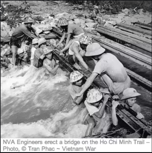
We were not attempting to “wash out river crossings.” The fords in the rivers and streams are in bedrock. The ample rainy season precipitation washes away mud and gravel, so there is mostly bare rock at the location of these fords. Any bridge would be difficult to construct, and subject to strafing and bombing during any construction, should a bridge have been constructed. We were trying to create higher water and faster stream flow to make personnel, bicycle, and vehicular fording more difficult and time-consuming, not “wash out river crossings.”
Laos was a mess. The new Kennedy Administration was a signatory of the Declaration on the Neutrality of Laos on 23 July 1962, in Geneva. We withdrew US forces we had in Laos, while the Pathet Lao withdrew fifteen people, and thereafter the Pathet Lao and North Vietnamese Army, with over 6000 troops, promptly took over almost all the areas in the east and south of Laos.
We then entered a secret war in Laos; we tried to interdict the traffic on the Ho Chi Minh Trail. The Ho Chi Minh Trail in Laos remained under Communist control during the war years with only an occasional incursion from Vietnam to the east.
We also provided direct air support to Gen. Vang Pao, attempting to keep the Pathet Lao at bay, and from attacking the capitol area around Vientiane. A good deal of that war was over the Plain of Jars; usually we called it the “PDJ.”
Novak: “no scientific data were collected to verify the claim….”
This comment displays complete ignorance of the military situation in Laos, Cambodia, and the US position in attempting to fight a war in the South with little ability to directly fight the enemy in the North, especially because President Johnson “would take no step that might possibly be interpreted as broadening the war, which he had publicly announced he would not do.”
What we did was fight an air war over Laos, and especially the Ho Chi Minh Trail to slow the flow of material to the South.
Think about it. How could we collect “scientific data” over the Ho Chi Minh Trail when it was occupied by the Pathet Lao and the Army of North Vietnam? Ignorance and lack of critical thinking skills by Novak are on full display.
However, data from the scientific and technical literature of the time, published in the Journal of Applied Meteorology and Technical Reports from NOAA’s Atlantic Oceanic and Meteorological Laboratories CLEARLY demonstrate the efficacy, operational, and technical results which enhanced both cloud growth and rainfall “to the 0.5% level.” In addition to not examining the technical literature, Novak apparently did not attempt to contact witnesses to this operation, the aircrews who flew the missions.
In my presentation, from Slides 108-114, I describe many results I saw during my missions over the Ho Chi Minh Trail in the wet season of 1969. Then, examining the published literature by Dr Simpson and her colleagues flying cloud seeding missions over the tropical Atlantic and Florida, descriptions of her work revealed by the General Accounting Office, you can read both their results and the results I observed and described.
In both cases, seeding tropical clouds resulted in seemingly identical effects, enhancing vertical growth, which the Florida experiments showed tripled, even quadrupled the precipitation over unseeded clouds with results statistically significant “at the 0.5% level.”
******************************
Our results during my missions in 1969 mimicked the Florida results, specifically “explosive growth” of seeded clouds. In Florida, members of the Simpson’s group reported merging of seeded clouds with some instances resulting in over 20 times the precipitation from unseeded clouds, while I described the development of a Mesoscale Convective Complex with copious rainfall, clearly the result of our work.
Novak: “General Westmoreland thought there was ‘no appreciable increase’ in rain from the project.”
My Reply: Exactly how was Westmoreland to know? This project was TOP SECRET at the time, and access was severely restricted but certainly General Westmoreland could have had access. As mentioned in my timeline, I was involved in writing the daily reports, also the quarterly summary reports to the JCS and others in the chain of command.
One of the weather briefers at the Headquarters commanded by General Westmoreland, the Military Assistance Command, Vietnam (MACV) was a colleague, Capt. Ted Stulloch, and as far as I know, neither he, nor anyone else at MACV requested information for any sort of tailored or special presentation to MACV on our project.
We used to say, “This is a Lieutenants’ and Captains’ war.” If Gen. Westmoreland had requested a special briefing or report, I would have either prepared it or been involved in preparing it. This did not happen during my tour.
In 1998, Harold A Winters wrote, “Battling the Elements, Weather and Terrain in the Conduct of War,” a book published by the Johns Hopkins University Press, which says in part:
“Using empirical and statistical techniques, it was determined that the rainfall had increased by approximately 30 percent in the targeted areas. This would lead to the intuitive conclusion that enemy logistically was at least slowed by cloud seeding…”
In Spring 2010, the University of Arizona Water Resources Research Center wrote, “Weather Modification, a.k.a Cloud Seeding, a Technology Whose Time Has Come,” https://wrrc.arizona.edu/awr/sp10/clouds
Novak wrote the GIZMODO piece in 2015, so the technical information on cloud seeding from the Journal of Applied Meteorology, NOAA Technical Memorandums, the book, “Battling the Elements, Weather and Terrain in the Conduct of War,” and the U of A paper, “Weather Modification, a.k.a Cloud Seeding, a Technology Whose Time Has Come,” were readily available from Internet Search when Novak’s piece appeared. His lack of scholarship in missing these publications makes his Gizmodo piece poor journalism.
Novak: “Melvin Laird testified at a Senate hearing on April 18, 1972 that, ‘we have never engaged in that type of activity over Northern Vietnam. That was a baldfaced lie.’”
My interpretation of this: It is likely this question was asked by Senator Claiborne Pell of Rhode Island, or one of his colleagues. The question seems to have pertained to asking if we had seeded clouds over North Vietnam, and Secretary Laird answered, “we have never engaged in that type of activity over Northern Vietnam.”
That statement by Secretary Laird was correct as he understood it at the time. At no time during the Nixon Administration which took office on 20 Jan 1969 did the project fly missions over North Vietnam. However, almost two years later, on 28 January 1974, Laird wrote to Senator Pell that he had “just been informed” that such activities had been conducted in 1967 and 1968, that is, only during the Johnson Administration.
A more recent report by David Reade seems to have many facts concerning the military aspects of cloud seeding well researched, in that Reade’s statements regarding this project match up with what I experienced and have investigated. With respect to Gizmodo’s Matt Novak calling Laird’s Senate testimony, “a baldfaced lie,”
Reade says, “Although some public record references suggest seeding flights were flown over North Vietnam, this is not exactly the case. In actuality, US DoD and Congressional (Popeye) records show that seeding flights into areas of North Vietnam only occurred for a few short weeks in 1967 and a 5-6 week period between September and early November 1968. Other than these very short periods in 1967-68, there are no other archival records or evidence that indicates Popeye ever flew over North Vietnam again.”
During my time on the project, we never to my knowledge flew into North Vietnam, nor was it even contemplated.
During my direct experiences with the war in Vietnam, 1966, 1967, 1969 and 1970, anytime any US military aircraft flew over North Vietnam, it was accompanied by suppression of air defenses such as the Iron Hand missions flown by the 388th TFW Wild Weasel birds with the Shrike Missiles that in 1966 could fly down the radar beams of the North’s SAM sites. When my B-52 unit attacked the Mu Gia Pass, the mission was TOP SECRET; we engaged in a feint by the first cell, and the mission was covered by Wild Weasel mission aircraft to prevent SAMs from attacking our bombers. We never, in my experience, sent unarmed military aircraft over North Vietnam; they would have been attacked fiercely.
Likewise, fighters from North Vietnam’s Air Force knew exactly where the “fence” between North Vietnam and Laos was, and never crossed over into Laos when US fighters were within air combat distance. I remember well debriefing Maj. Don Madonna from the 388th TFW in the spring of 1969 immediately after he returned as flight lead on a mission where North Vietnam’s MIGs crossed back into North Vietnam’s airspace before Madonna’s flight could engage and attempt to shoot them down when they were still over Laos.
The notion that an unarmed WC-130A would enter defended airspace of North Vietnam and conduct cloud seeding in the 20,000 to 23,000 ft. altitude range over a 4-5-hour mission without an accompanying substantial Suppression of Air Defenses is to me, positively ludicrous. Just think of the 1970 attempt to free the POWs at the camp at Son Tay, and the planning to avoid interference by the North Vietnamese. The mission to give US air superiority for a few minutes at Son Tay required months of planning plus direction and resources allocated from the JCS.
One of my former colleagues from the Air Force described doing the weather briefings for the May 1966 C-130 CAROLINA MOON missions flown out of Danang AB. They targeted the Thanh Hoa Bridge in North Vietnam, flying low level, below 500 ft., to avoid detection and destruction. The second attempt resulted in the loss of the C-130 while attempting to mine the bridge, attempting an upstream drop of floating mines.
This story brings home the extreme danger of flying unarmed C-130s over North Vietnam, even flying below the hills. A lumbering transport flying above 20,000 ft. over North Vietnam would have resulted in immediate attack and loss. The threats from SAMs and MIGs against such flights was incredible; Novak’s naïve prose lacks understanding of the situation.
The Senator asked the wrong question, and Secretary Laird, feeling no need to correct an incorrect question, answered correctly to the knowledge he had of the Nixon Administration’s pursuit of military objectives in Vietnam.
Novak might have gotten some things right, but there are so many things wrong with his GIZMODO piece, I would call it Fake News.
Finally, to answer the question asked in the title, “Human-Caused Climate Change? Possible Lessons from Weather Modification Operations During the Vietnam War.”
In my opinion, and well-established from the record, Climate Alarmists and Weather Modification Alarmists use the same playbook, take a simple observation and extrapolate wildly, hoping to gain political capital from alarmism. I have documented wild climate alarmism many places in this blog, but a convenient post of reference is, https://casf.me/critique-fourth-national-climate-assessment/, where claims of ,”The last few years have also seen record-breaking, climate-related weather extremes,” are shown to be false, simply looking at weather records for hurricane numbers, hurricane strikes on the USA, severe tornado numbers and similar figures of merit. They all show the claim to be false.
In the case of US cloud seeding efforts in Laos, claims, especially those of the late Senator Claiborne Pell, D-RI, were wild, unscientific, lacking in critical thought, and without looking up the actual weather events he claimed to have happened. Nonetheless these wild accusations were printed verbatim in the press without the slightest hesitancy by the editors, nor even the slightest, “on the other hand” mention of contrary views one might expect from a journalist.
This shows that the wild claims of ongoing or imminent climate catastrophe and weather modification alarmism are varieties of a similar mind-set, make wild claims untouched with the least evidence, blame the US first, and hope to diminish efforts to improve the lives of those in the US and other parts of the world. This playbook has little to worry about, those of us who engage in critical thought and examine the alarmist claims will be ignored by the Main-Stream Media in broadcast and print formats, and the lack of critical thought processes will allow the claims to be made unimpeded by the truly educated.
Selected References:
“The Secret Weather Manipulation of the Vietnam War,” https://paleofuture.gizmodo.com/the-secret-weather-manipulation-program-of-the-vietnam-1689249533.
Seymour Hersch wrote on this for the New York Times, 3 Jul 1972, https://www.nytimes.com/1972/07/03/archives/rainmaking-is-used-as-weapon-by-us-cloudseeding-in-indochina-is.html
Harold A Winters et al, “Battling the Elements Weather and Terrain in the Conduct of War,” https://jhupbooks.press.jhu.edu/title/battling-elements
Simpson, J.E., et al, “An Airborne Pyrotechnic Cloud Seeding System and Its Use,” Journal of Applied Meteorology, Feb 1970., pp.109-122
Woodley, W.L., et al, “Precipitation Results from A Pyrotechnic Cloud Seeding Experiment,” Journal of Applied Meteorology, August 1969, pp. 242-257
Woodley, W. L, et al, “Some Results of Single Cloud Pyrotechnic Seeding in Florida, 1970,” NOAA Technical Memorandum, ERLTM-AOML 10, November 1970.
GAO’s 31 May 1972 reply to Sen Schweiker, B100063, from the Comptroller General, https://www.gao.gov/assets/210/204166.pdf]]
“Weather Modification, a.k.a Cloud Seeding, a Technology Whose Time Has Come,” University of Arizona Water Resources Research Center, Spring 2010 Newsletter, https://wrrc.arizona.edu/awr/sp10/clouds
Pierre St-Amand bio at,
https://www.ridgecrestca.com/article/20110421/news/304219995
Reade, David, The Unrealized History of the Military’s Utilization of Weather as a Weapon, the “Real” Father of Weaponized Weather and the Secret Hurricane Modification Program Nobody Has Ever Heard Of, http://p3 publications.com/PDF/TheUnrealizedHistoryofWeaponizedWeather2015.pdf